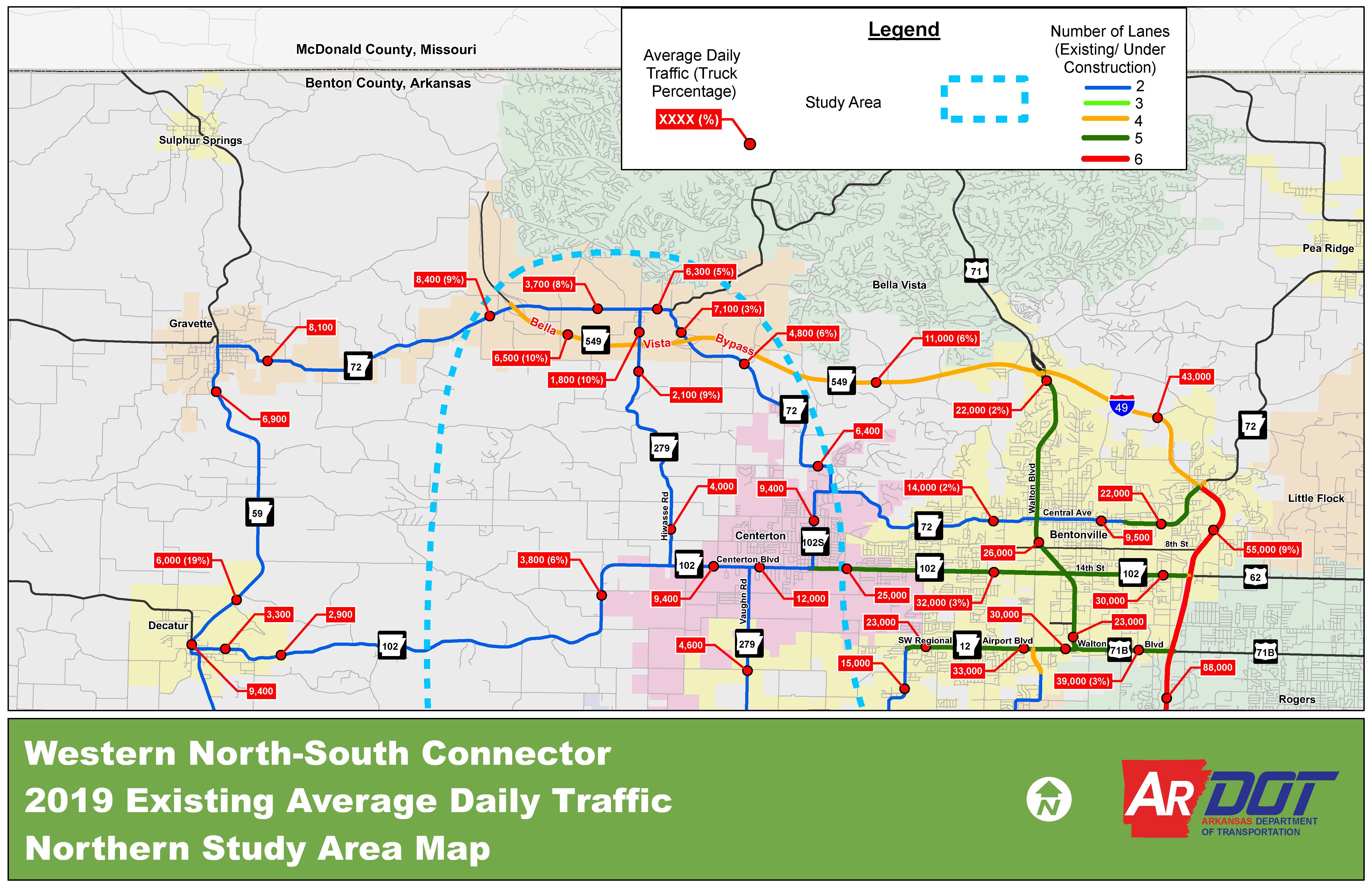
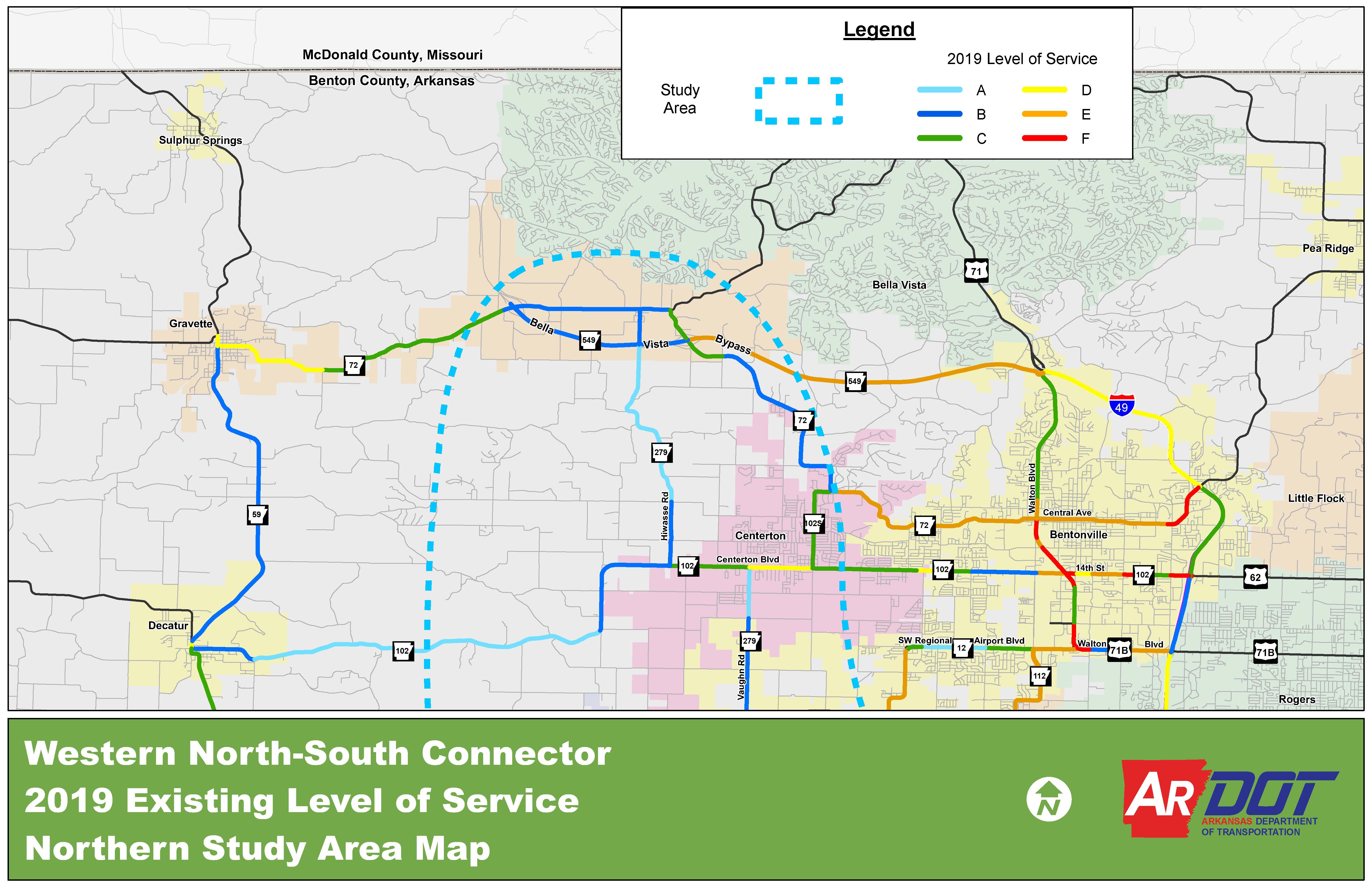
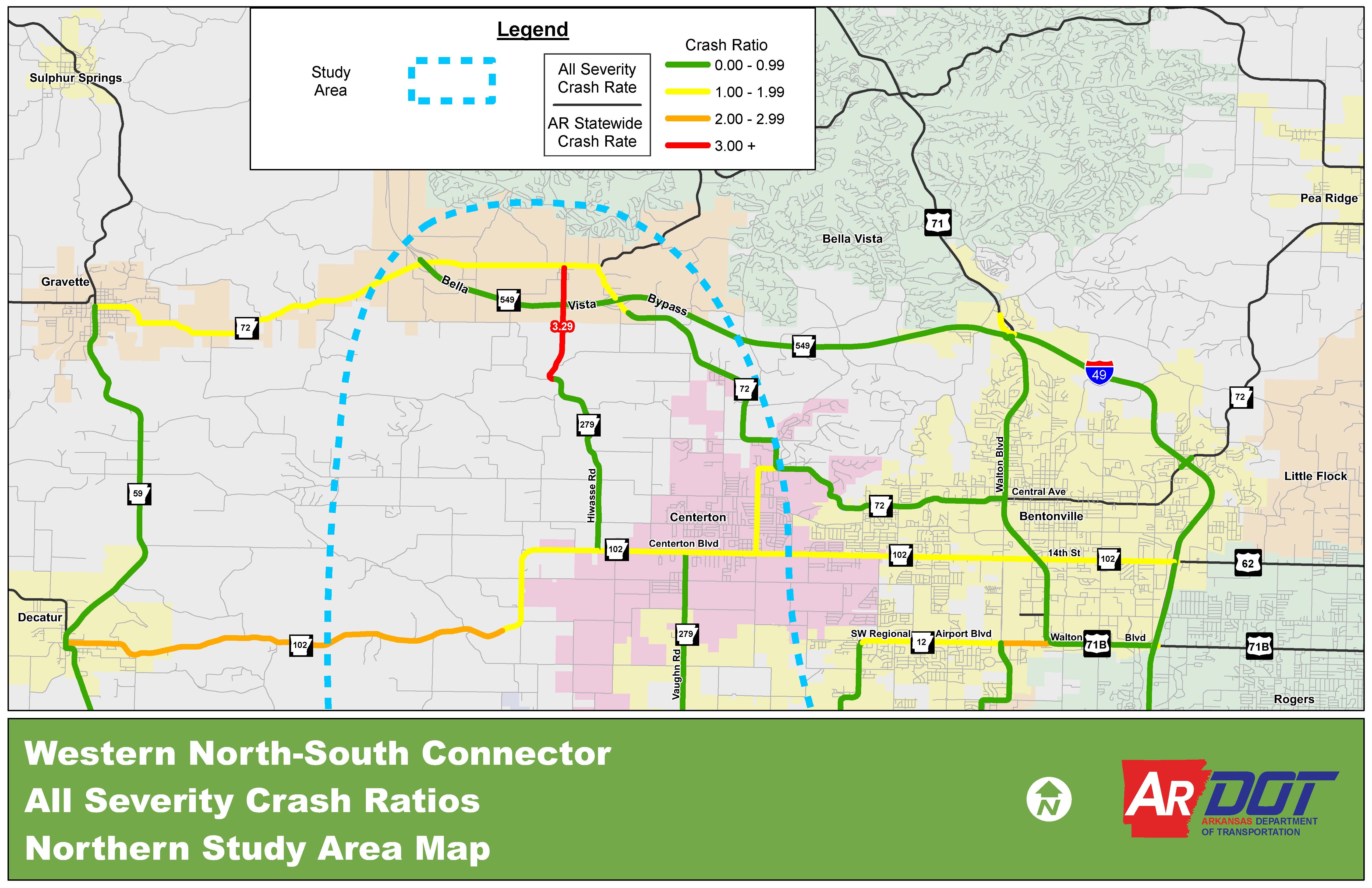
exhibits
Exhibits & Materials
Please take a moment to view the map sets below by clicking on each image. Each map set contains multiple pages.
Alternatives Maps
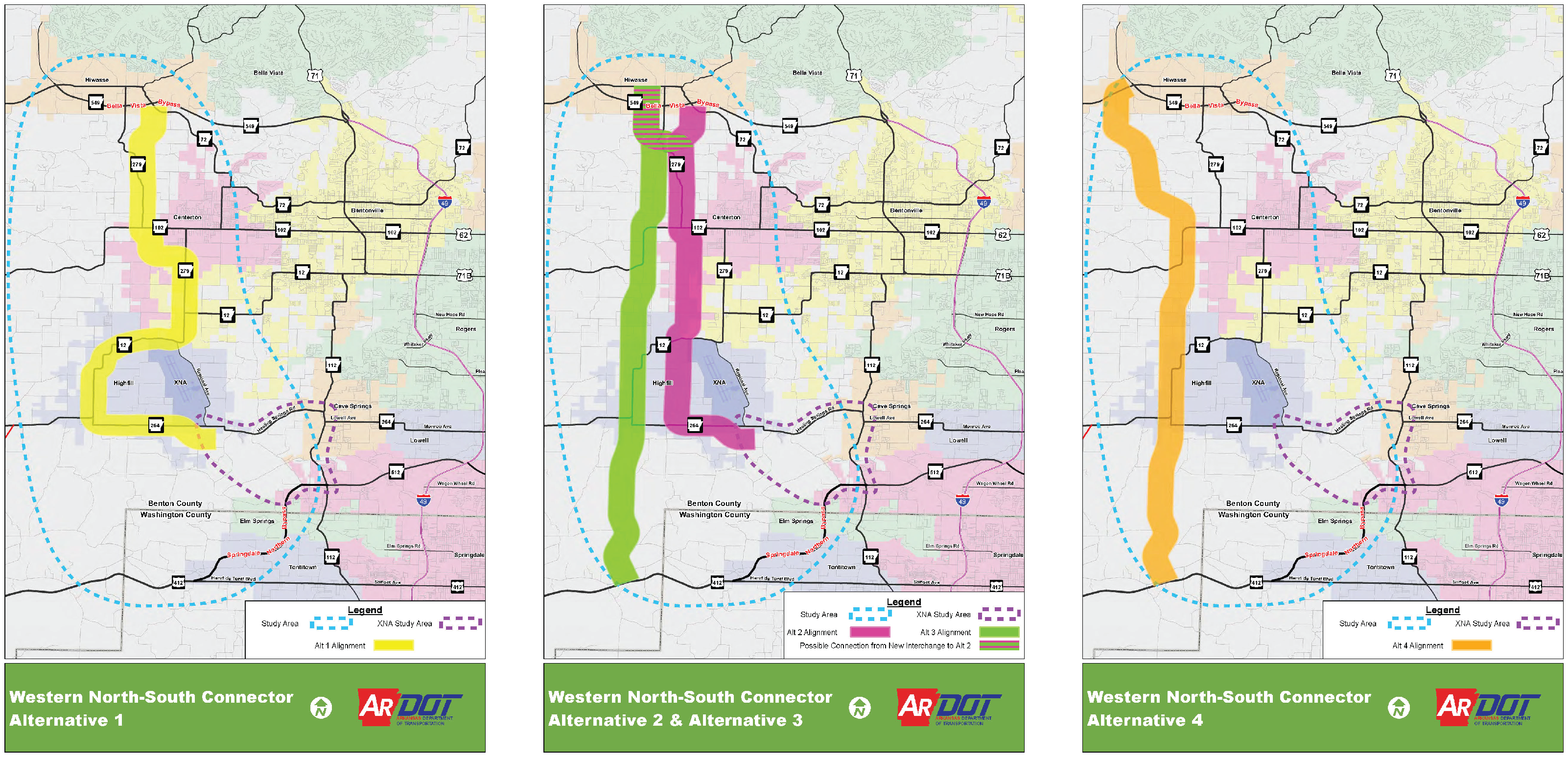
On the alternatives maps, 3/4-mile-wide alignment buffers are shown to provide a general idea of where the Western North-South Connector could go. Ultimately, a new roadway would be much narrower, and the final location would be aligned to minimize property impacts. In many cases, the Western North-South Connector could follow existing roads or those that cities have already proposed in their Master Street Plans.